


PeakVisor - 3D Maps & Peaks ID
3.842.00 Reviews
App Specs
- Version
- 2.9.67
- Updated On
- License
- Free
- Downloads
- 100,000+
- Developer
- Routes Software SRL
- Categories
- Travel & Local
- Platform
- Android, iOS
Screenshots
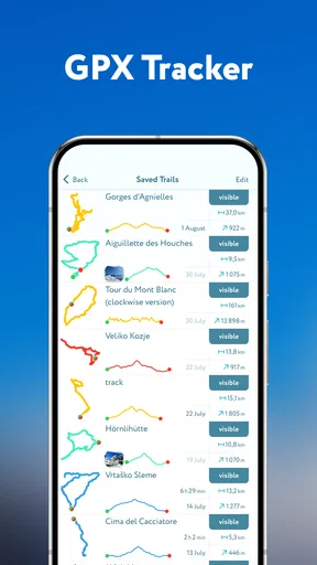
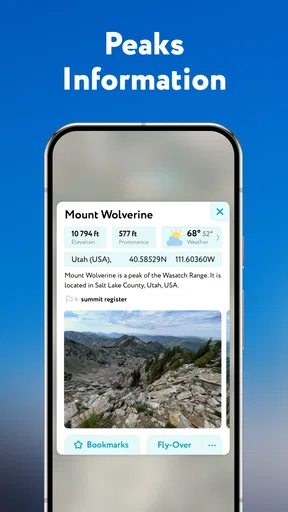
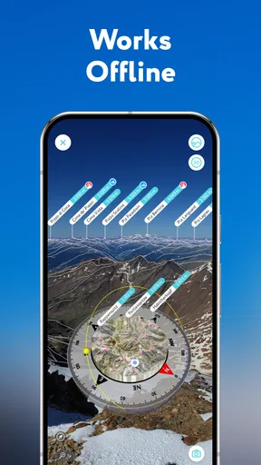
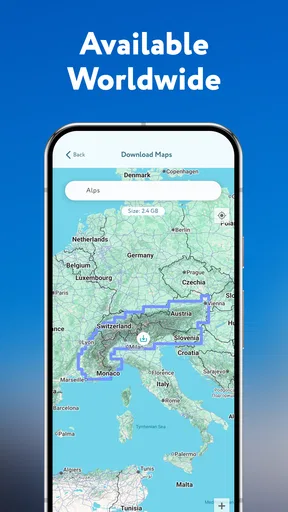
 Analysis by AppCompare
PeakVisor is most compelling when a mountain landscape makes you curious: it can turn a distant skyline into something you can identify and explore. I like that mix of practical orientation and learning, though I would treat it as a companion to a sound route plan rather than a substitute for one. Its 3D view and peak labels make it feel different from a conventional map, but the value depends on whether you spend time in mountainous places and want more than a line showing where to walk.
A mountain view with more context
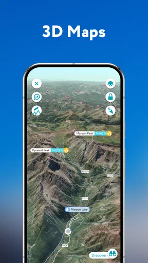
For a familiar hiking app, the usual question is where a trail goes and how to follow it. PeakVisor adds another question: what am I looking at? That distinction matters on a ridge, at a viewpoint, or even during a short stop on a walk. Seeing names and elevations against the surrounding terrain can make a landscape easier to understand, and it gives curious hikers a reason to look up from the route.
I find that most useful when the scenery is unfamiliar. Before a walk, the 3D map can help me build a mental picture of the terrain rather than relying only on a flat route line. During a hike, identifying a visible summit can give the day a stronger sense of place. Afterward, the same details can help me remember which ridges I saw. It is a small shift in how I use a map, but a worthwhile one for someone who enjoys geography as much as reaching the destination.
What to check before setting off
Offline use is valuable in places where a mobile connection may be unreliable, but it rewards a little preparation. I would open the area I plan to visit and make sure the relevant map is ready before leaving home or a place with dependable service. It is also sensible to check that the phone has enough battery for the walk; a map that works without a connection still depends on a charged device.
For a longer outing, I would use the app to get oriented and inspect the surrounding peaks, then keep a separate safety routine: tell someone the plan, carry what the conditions call for, and avoid relying on one screen for every decision. The practical trade-off is that a visually rich map is engaging, but looking at a phone too often can distract from the ground, weather, and trail markers. I prefer to check it at a stop rather than walk with the display constantly in front of me.
Where it fits among other map apps
Compared with a standard navigation app, PeakVisor is more focused on interpreting the mountain scene than on everyday directions from one address to another. A general map is usually the simpler choice for city travel, driving, or finding a nearby shop. A dedicated route-planning tool may suit someone whose main concern is choosing and following a particular trail. PeakVisor makes more sense when the terrain itself is part of the experience and identifying peaks is a reason to open the phone.
That focus is also a limitation. Someone who hikes rarely, walks mostly in flat or urban areas, or only needs a basic route may not get enough out of a specialist mountain view to justify learning another app. Likewise, I would not assume that a named peak or an appealing 3D perspective tells me whether a route is safe or suitable today. Conditions, closures, fitness, and local advice still matter. The app can add context, but judgment belongs to the hiker.
Worth Reading Before You Choose

Flipboard Shows What News Apps Must Do Beyond the Feed

Switching to Android Auto Means Rethinking Your Driving Routine

Google Calendar Makes a Crowded Week Easier to Manage

Ludo King Makes the Most of the Minutes Between Plans

Baby Panda World Brings Quick Play to Modern Phones, but Its Game Library Feels Busy

ESPN’s Live Game View Makes Following Close Games Easier
A practical outing, not just a feature demo
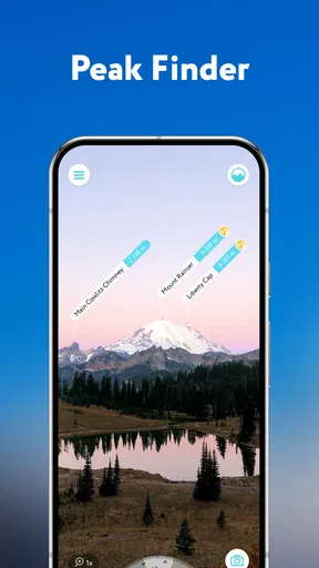
Imagine arriving at a trailhead for a weekend walk in a range you have not visited before. Before setting out, you can look over the 3D terrain and get a sense of which summits surround the route. At a viewpoint, the identification feature can answer the question everyone in the group eventually asks: which peak is that? If the signal fades later, having prepared the map beforehand may help you continue consulting it. On the way back, the terrain profile can offer another way to think about the route you have just crossed.
There is a useful group-workflow here, too: one person can check the map at a safe stopping point and share the names and elevations with the others, instead of everyone trying to use a camera view at once. That keeps the app from becoming a distraction and makes the information part of the outing. For a solo walk, I would use the same pause to check orientation, then put the phone away and pay attention to the trail.
Small choices that improve the experience
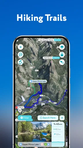
The sun and moon information is best treated as planning context, not a promise that a route will be comfortable or safe at a particular time. I would think about daylight before leaving, then allow a margin for slower progress, rests, and changing conditions. The terrain profile can also help me notice that a route is not just a distance on a screen: elevation changes affect effort, and a short-looking section may feel very different on foot.
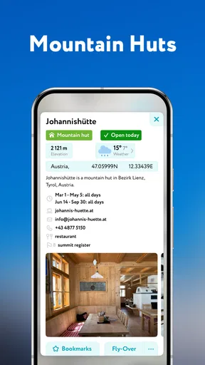
The points of interest broaden the app beyond summit spotting. Castles and huts can give a walk an additional destination or help make a route more engaging for companions who are less interested in peak names. Still, I would verify that a stop is accessible and appropriate for the planned outing rather than treating its appearance in an app as a guarantee. A point on a map is a useful prompt for research, not a substitute for checking local details.
Who is likely to appreciate it
I would recommend PeakVisor most to hikers who regularly visit mountainous areas, enjoy learning the names of the landscape around them, or like studying terrain before heading out. It is also a good fit for a group where someone naturally becomes the person who answers questions about the view. The combination of visual exploration and practical map context gives that person more to do than simply follow a route.
It is less convincing for someone who wants only turn-by-turn directions, needs a simple everyday map, or rarely goes somewhere with peaks to identify. New hikers can still enjoy it, but I would encourage them to learn basic navigation and outdoor preparation alongside it. A clear interface does not remove the need to understand a route, carry suitable equipment, or make a conservative decision when conditions change.
Cost, availability, and expectations
PeakVisor is a free travel and local app from Routes Software SRL, with in-app purchases offered for people who want to consider paid options. The free starting point makes it easy to see whether mountain identification and 3D terrain fit your habits before deciding whether you need anything beyond it. Purchases range from $11.99 to $184.99 per item, so I would check what a particular option includes and whether it matches the way I plan to use the app before spending.
It has a 3.8 average from around one thousand ratings, with 42 written reviews, and has been installed over 100,000 times. It is rated for Everyone, was released on June 14, 2017, and the current version is 2.9.67, requiring OS 10 or later. Those details help set expectations about availability and audience, but they do not tell me whether the app will suit a particular route; I would judge that by trying it in the places I actually hike.
Getting Started with PeakVisor
The first thing you'll notice about PeakVisor is how intuitive it is. After downloading, I launched the app and was immediately greeted with a sleek interface. It's user-friendly, which is a huge plus when you're out in the wild and need quick information. The app didn't bog me down with lengthy tutorials or complicated settings. Instead, it felt like a natural extension of my hiking gear.
3D Mapping and Real-Time Navigation
This feature is what truly sets PeakVisor apart. The 3D maps are incredibly detailed and provide an immersive view of the terrain. I found myself exploring regions like never before. It’s like having a bird’s-eye view where you can zoom in and out, rotate, and explore the landscape. The precision in detail is outstanding. I could see trails, peaks, and even minor geographical features that are often ignored. The app provides real-time navigation, helping me stay on track during my adventurous hikes.
Peak Identification
One of the coolest features has to be the peaks identification. I remember standing on a ridge, surrounded by mountains, and wondering about their names. With a simple point of my phone camera, PeakVisor identified them all. It overlays the names and elevations in real-time, making me feel like a seasoned mountaineer. It’s a fantastic learning tool and adds an educational layer to any hiking experience.
Offline Capabilities
Let’s face it, not all hiking trails have the best cell service. Thankfully, PeakVisor has got us covered with its offline capabilities. Before heading out, I downloaded the maps of the area I planned to explore. The offline mode functioned seamlessly, and I experienced no lag or glitches. It’s a lifesaver when you’re deep in the woods and need reliable maps without an internet connection.
Additional Features
The app doesn't stop at just mapping and peak identification. It includes a sun and moon tracker, which is handy for planning your hikes around daylight hours. There’s also a terrain profile view, which provides a cross-section of the terrain. This helps in assessing the difficulty of certain trails and planning accordingly. The app even has a database of castles, huts, and other points of interest, making it versatile for various outdoor adventures.
PeakVisor also syncs with your smartwatch. This integration is perfect for those who prefer to keep their phones tucked away while navigating trails. I found it convenient to glance at my wrist for quick information without breaking my stride.
Final Thoughts
In a world where apps are a dime a dozen, PeakVisor - 3D Maps & Peaks ID stands out as a must-have for outdoor enthusiasts. Whether you’re a casual hiker or someone who regularly tackles challenging trails, this app enhances the experience. The 3D mapping, peak identification, and offline capabilities are not just features—they’re essential tools for any adventurer.
Now, next time you’re out there, standing in awe of nature's majesty, you’ll know exactly what you’re looking at. And trust me, there’s something incredibly satisfying about that. So, lace up your boots, grab your phone, and let PeakVisor guide you through the mountains like never before!
Pros
- Highly accurate 3D mapping for hikers.
- Offline access to maps and peak data.
- Augmented reality feature for peak ID.
- Intuitive and user-friendly interface.
- Regular updates with new locations.
Cons
- Requires a premium subscription for full features.
- Battery intensive on long hikes.
- Limited coverage in remote areas.
- Occasional lag in AR mode.
- Initial learning curve for new users.
FAQs for PeakVisor - 3D Maps & Peaks ID
What features does PeakVisor offer for mountain enthusiasts?
PeakVisor provides a comprehensive set of tools for mountain enthusiasts, including 3D maps, peak identification, and detailed hiking routes. The app can identify over a million peaks worldwide using your phone's camera, displaying their names and altitudes. It also offers offline maps, making it a versatile tool for outdoor adventures.
Is PeakVisor available for offline use?
Yes, PeakVisor offers offline maps, which is ideal for areas with limited or no internet connectivity. Users can download specific regions in advance, ensuring access to map data and peak information while exploring remote locations. This feature is particularly useful for hikers and climbers who frequent areas with spotty service.
How accurate is PeakVisor’s peak identification feature?
PeakVisor uses advanced augmented reality (AR) technology and a vast database to accurately identify peaks. The app is known for its high accuracy, recognizing over a million peaks worldwide. However, accuracy can depend on factors such as camera quality and weather conditions, so it's always good to double-check with a map.
What devices are compatible with PeakVisor?
PeakVisor is available for both Android and iOS devices. It requires a relatively recent operating system to ensure compatibility with its advanced features, such as AR and 3D mapping. Users should make sure their devices are updated to the latest OS versions for optimal performance.
Does PeakVisor require a subscription or in-app purchases?
While PeakVisor offers a free version with basic features, accessing its full suite of tools requires a subscription. The subscription unlocks premium features such as offline maps, unlimited peak identifications, and more detailed route information. Users can choose from monthly or yearly plans depending on their needs.


